
Volcano or Leopard Skin? July 23, 2016
Author: Beach Combing | in : Prehistoric , trackback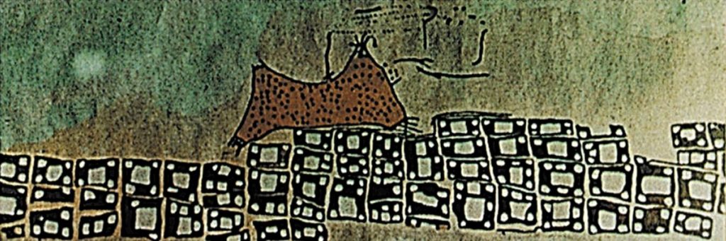
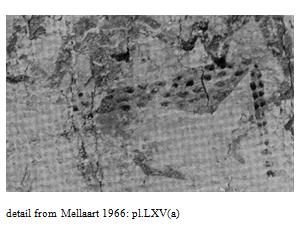
It is regularly cited as the earliest map in the world (‘the greatest find in cartographic history’); it is ‘certainly’ our earliest landscape painting. Here, at level VII, in one of the world’s first cities, Çatalhöyük in Turkey, is a remarkable mural. A group of tessellated squares that appear to be houses painted beneath a twin mountain, one of which might be erupting: the claim was first made in 1964 by the original excavator of Çatalhöyük, James Mellaart. Mellaart was particularly excited by this image because the mountains match the nearby Mount Hasan, which has a characteristic dual peak. And wait for it… Geologists have examined the mountain in question and established that not only is it a volcano but it was active in the relative period, 6430–6790 BC, so slam dunk and back slaps all round. Only, there is an irritating minority opinion, but one that it is only proper to share. An archaeologist Stephanie Meece looked at the painting and saw not a mountain blowing lava with a terrified village below but… a leopard skin hung above some geometric shapes. At this point it might be worth showing a photograph of the original mural.
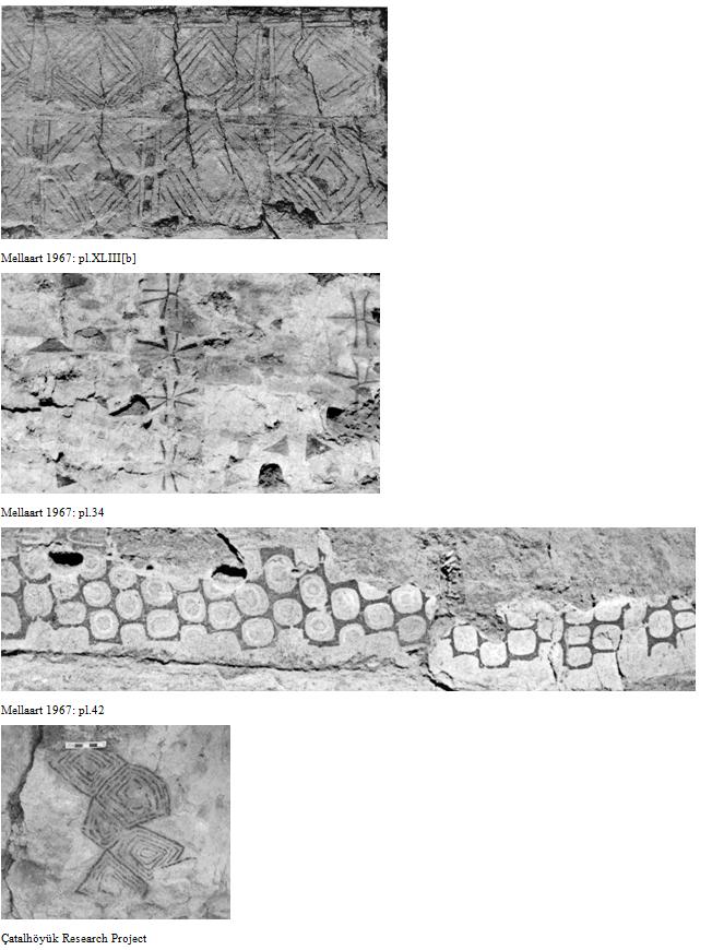
In 2006, she published an article* and made a strong argument. Leopards are a favourite animal at Çatalhöyük, in terms of decoration: they were not yet extinct in Anatolia.
Geometric designs are also common at the site.
For Beach though the crucial part of the argument is the fact that the mountains in the picture do not resemble the mountains as seen from Çatalhöyük:
In Mellaart’s 1967 monograph, a photograph of Hasan Dağ is included… from an angle with accentuates its two peaks. This photo was not taken from Çatalhöyük, however, but rather from the Aksaray-Nevşehir road, looking south toward the peaks, rather than east towards them, which would have been the orientation from Çatalhöyük. The photograph of Kara Dağ in the 1967 volume… was indeed taken from the mound, but Kara Dağ is not a volcano. Additionally, though Hasan Dağ has two peaks, when viewed from the direction of Çatalhöyük the higher peak is on the left and the smaller on the right; in the ‘map’, this is reversed. Mainly because of this reversal of the peaks, Ülkekul… believed that the ‘map’ depicted Melendiz Dağ, also an extinct volcano, located near Niğde in Cappadocia. Melendiz Dağ has three peaks, however; discounting the third, (as it ‘seems to be in a separate position’… Ülkekul claimed that the heights of the peaks are in the same proportions as those depicted on the ‘map’. To photograph Melendiz Dağ, Ülkekul had to travel as far east as Aksaray, choosing a vantage point on the Aksaray-Ulukısla road.
In short Dr Meece makes a very strong case. The world would have to wait until about 4000 BC for the first maps in Mesopotamia, c. 1500 BC. What Beach finds most fascinating here is the triumph of the volcano over the geometric shapes argument, cemented with a geological study of the volcano in 2014. The more serious sites include the minority opinion, but news outlets generally do not. It is a nice example of how sex sells: volcanoes will make it into the Daily Mail, geometric shapes never will…
Beach is always on the look out for competing interpretations of ancient pictures: drbeachcombing AT yahoo DOT com
PS For other supposed ancient volcanoes.
* Meece, Stephanie (2006) A bird’s eye view – of a leopard’s spots. The Çatalhöyük ‘map’ and the development of cartographic representation in prehistory. Anatolian Studies 56:1-16
EC, 27 Jul 2016: ‘I strongly doubt the ancients used meaningless geometric abstractions. I suspect all ancient symbols had meaning for their intended audience. If Meece is right – and his case seems to have merit – he still leaves unexplained the shapes below the skin. Note that they are irregular, very unlike the other geometric patterns you give as examples. They seem to be depicting something, though what I don’t know.’ I [Beach] agree with the difference between this and the geometrical shapes.
Stephen D, 27 Jul 2016: I don’t know if you’ve read the paper by Sébastien Nomade et al., “A 36,000-year-old volcanic eruption depicted in the Chauvet-Pont d’Arc cave (Ardèche, France)?” PLoS One, earlier this year. It’s early in the morning, my mind is still foggy and uncaffeinated, I may well have learned about it from your site, in which case apologies.
Bruce T, 27 Jul 2016: It’s so tough to determine from both the photo of the mural and the enhanced drawing. What’s spurting out of the mountain/skin could be lava or it could be blood. What is intriguing is the lava/blood is coming from both the lower left corner and the upper right “peak”. If you notice there is a pointed line that closely resembles a spear or a dart just behind the peak. This where the kill shot is ideally placed to this day with any animal, into the side, above front leg joint to pierce the lungs and major arteries around the heart. I also see a crook-like shape in the enhanced drawing above and to the right of the pointed line that is awfully close to how early throwing sticks were depicted in both Neolithic Egypt and parts of the Levant. The drawing of Catalhoyuk in the link provided didn’t help a lot as it’s obviously based on the geometric patterns below whatever is depicted in the enhanced mural. Even the wall structures surrounding the settlement reflect the depiction of what is thought to be a village in the mural. I don’t think exactly where the pictures were taken is the factor. The thing that stands out to me is the sheer distance to the proposed volcano. The people in the town may have seen the smoke, glow, felt the ground shake, and heard the reports. It’s likely they wandered over to get a closer look and saw it in action. Even then, why would they depict a distant volcano as looming over the town? It’s not a clear case by any means,but I’ll let the experts dual it out. They know more about the site, geography, and early cultures of the region than either of us.

