Inuit as an Unlikely Source for Medieval Charts January 29, 2013
Author: Beach Combing | in : Medieval, Modern , trackbackCould you draw a perfect, to scale map of the area that you live? Close your eyes, consider the fields, the rivers and streets and then give it a go. After you’ve spent ten minutes with some coloured crayons compare your effort with a professionally produced map, contours and all. The chances are that you will be embarrassed and depressed. But there is no reason you should feel this way. After all, once we stopped hunting and being killed out in our environment our need to register perfectly every lump of earth receded rapidly as we had other more important things to worry about: taxes, barbecues, reality TV… The same thing happened to memory when humanity began to write: ink is brain acid.
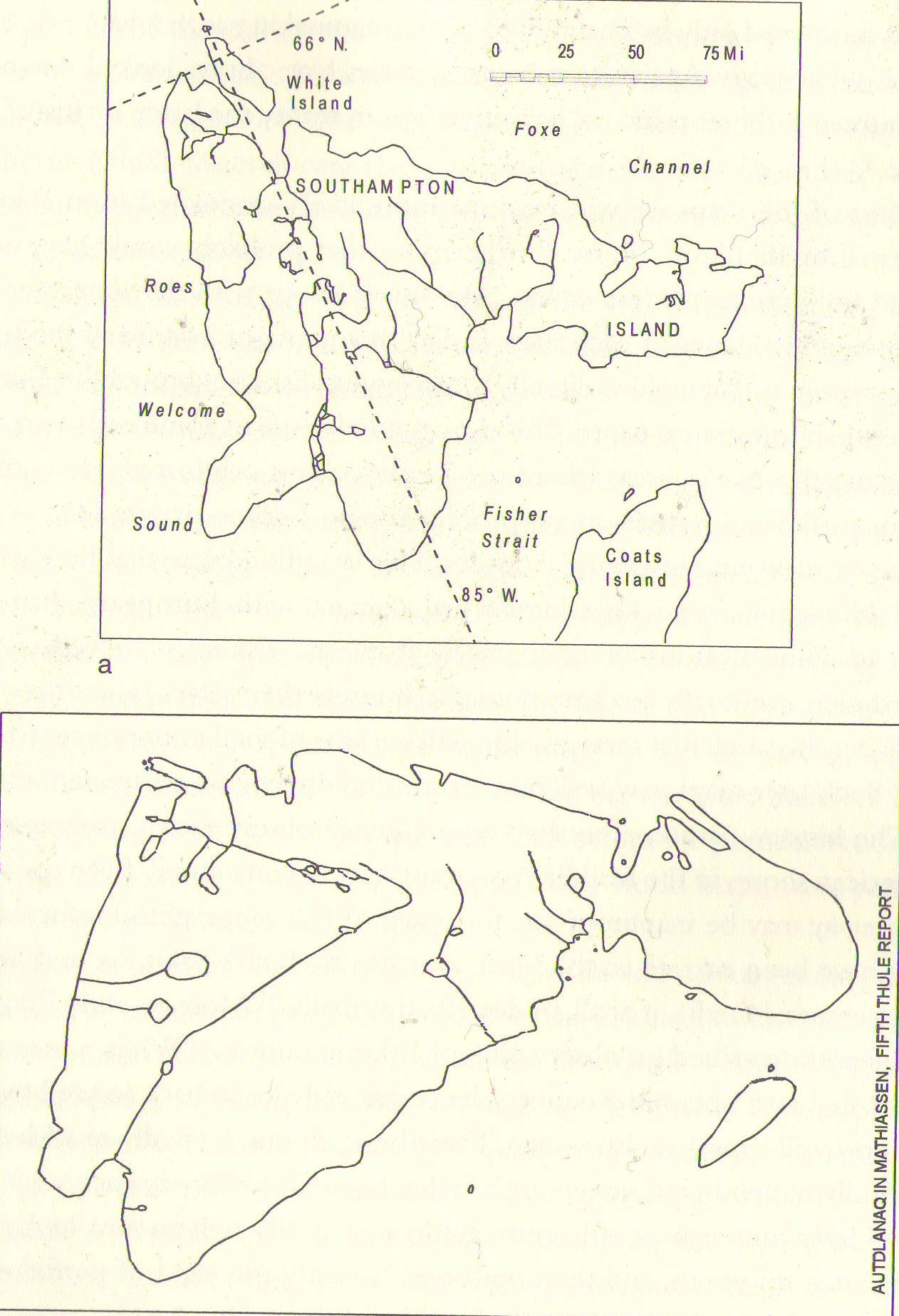
But Beach was recently fascinated to come across an example of a ‘native’ map from the Canadian Arctic Archipelago. The top map is a modern to scale map of Southampton Island at the top of Hudson Bay and the bottom map is one of the same area created by an Inuit and collected by a Dane on the Fifth Thule Expedition (1921-1924). Beach finds the level of detail absolutely stunning. This island is over a hundred miles across… The Inuit in question was presumably illiterate.
The scan comes from a controversial book that deserves at the very least a nod in this place. James Robert Enterline is a talented amateur historian who has taken a great interest in the history of maps, particularly in his recent Erikson, Eskimos & Columbus (2002). RE puts Inuit map-making knowledge at the very centre of his book, arguing that Inuit maps were taken up by Greenlanders and from there leaked back into Europe to appear on European charts from the fourteenth century onwards.
This is a thesis that has not garnered anything near majority support among experts: it just stretches credibility to breaking point to believe that Alaska could appear on a medieval European map because an Inuit told a Greenlander who told a Dane who wrote all this down… It is one thing to get a sense of the lay of the land in smallish Southampton Island, quite another to find your way to understanding the outlines of Continental Alaska.
But Enterline’s books is one of those fabulous works that, even if you disagree with every word, is provocative and interesting without ever leaving the rails of science. It is also refreshing to see the Inuit placed into the driving seat, after centuries of being ‘dumb’ observers of medieval Viking visits to their territory.
Beach is always on the look out for interesting books? drbeachcombing At yahoo DOT com


