
American Indian Map Making: A Rare Talent? March 3, 2014
Author: Beach Combing | in : Medieval, Modern , trackback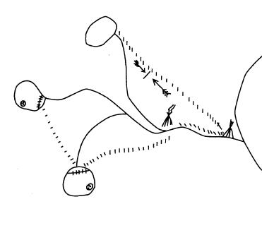
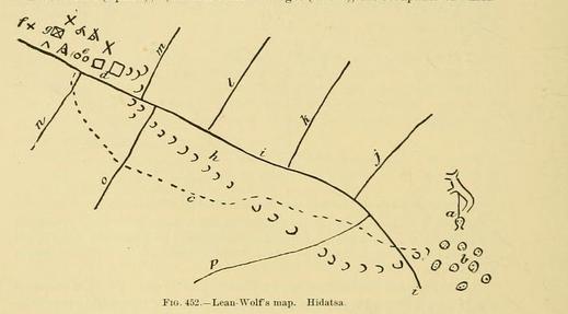
Mapmaking is often seen as a modern, even a western preoccupation. But, of course, map-making, albeit with rather different rules, has existed in other cultures from the earliest times. This is true even in hunter-gatherer societies where permanent records are slighter and more difficult to achieve. After all, the hunter-gatherer depends more on knowledge of the landscape than the city-dweller or the settled farmer: maps are a necessary tool in the battle for survival, even temporary twig maps or maps scratched in the sand. We have noted before extraordinary recall in Inuit snow sketches of landscape. Consider, now, first the map above which was drawn on birch by a Penobscot Indian. Note the lakes, the rivers, the lake and the beaver damns. The dashed lines are trails. Below, instead, is a narrative map. Here you can see Lean Wolf’s raid to steal a horse from Indian neighbours: note the horse tracks coming back: Lean Wolf was successful.
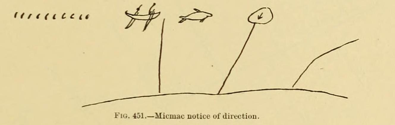
Here is another kind of map: a war message of uncertain date (nineteenth century?). A Micmac Scout has seen ten Passamaquody enemies heading down the river in a canoe: there are the dashes, the totem sign of the Passamaquody and the arrow that shows directionality. This was allegedly left on a tree for a sentinel.
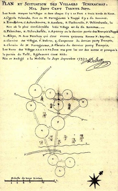
Below, instead, is an Amerindian pass at sociology among the Chickasaw, dating to 1737, for a French visitor (who copied it out). The circles are the various villages and are linked together giving some sense of distance and interrelations in a complex society. The French visitors who recorded maps like this (and there are several from the eighteenth century) often described their skilled interlocutors as sauvages, despite their evident control and knowledge of the environment around them.
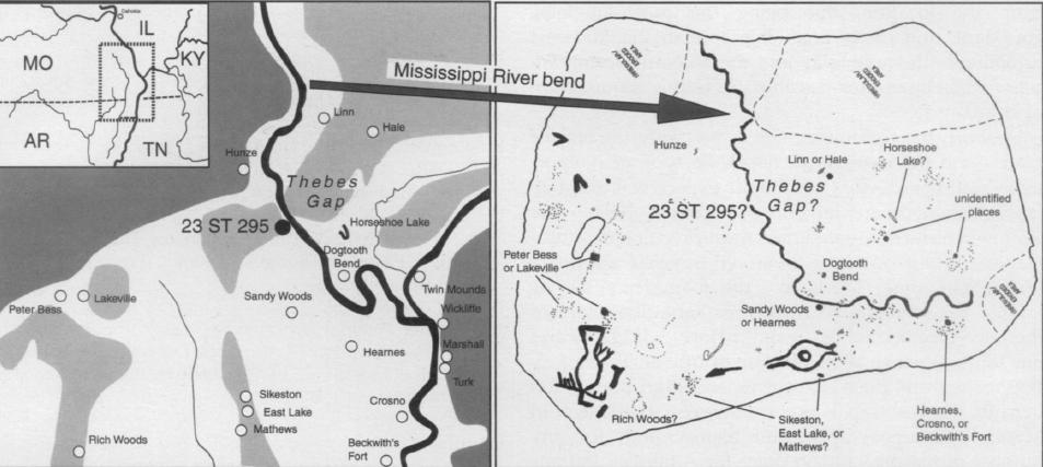
Next, we have a possible petroglyph map, perhaps even the oldest American map. The authors of an article in 2008 (F.Terry Norris and Timothy R. Pauketat ‘A Pre-Columbian Map of the Mississippi’ Southeastern Archaeology 27, 78-92) argued that a petroglyph at a prominent point on the Mississipi showed visitors the local tribal geography. So do we have an early rock map: dating 1050-1600? Or is this wishful thinking? Compare the modern map with the petroglyph map (if that is what it indeed is). Intriguing stuff and the article is to be recommended.
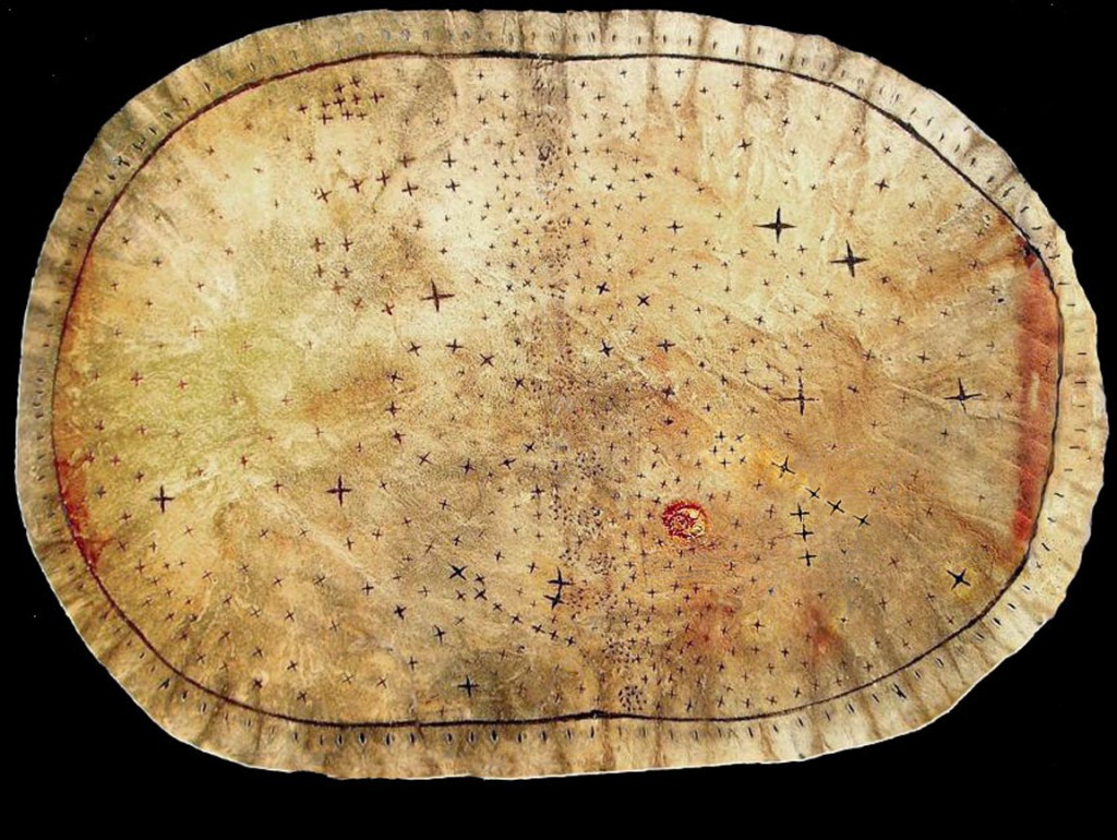
Finally, we have the jewel in the crown. A Pawnshee sky map of the stars, seen from a uniquely Indian perspective in the nineteenth century. Again humbling and beautiful.
Any other hunter-gatherer maps from around the world? drbeachcombing AT yahoo DOT com Memories of that fabulous map of Tupaia, the Pacific Islander who accompanied Cook on his voyages in the South Sea. If you’ve never seen it…

