
The Mystery of the Victoria Reservoir at Southport March 22, 2015
Author: Beach Combing | in : Modern , trackback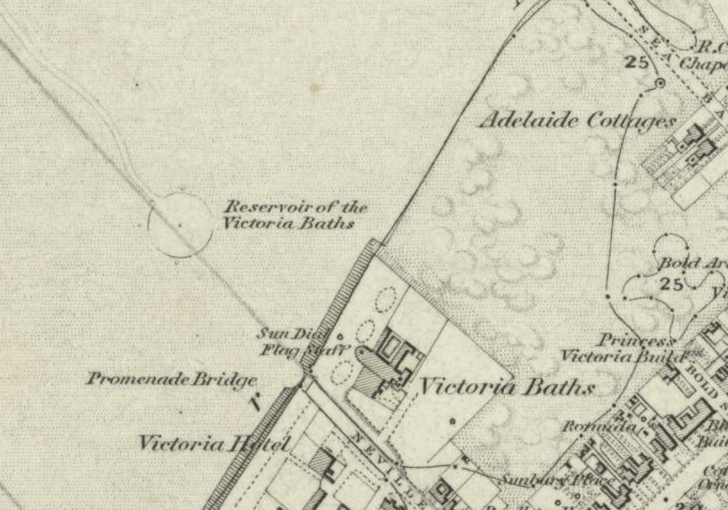
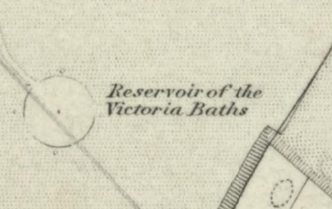
Southport is a Lancashire seaside town. In the nineteenth-century Southport had something of a reputation, tourists flocked from throughout the north and in 1860 Southport would build the second largest pier in Britain: a big deal back then when coast towns measured their self esteem by ‘how long’ they were. At the centre of these exciting developments was the Victoria Baths, constructed in 1839, a series of covered sea water baths. Included above is an OS map from 1850, and it was this map that offers a mystery. The Victoria Baths are looking immense and lovely, once the railway line arrived from Liverpool in 1848 and Manchester in 1855 Southport became irresistible for those looking for fun or a bathing cure. But wait what is that outside on the beach? The OS map in 1848 labels it as the Reservoir of the Victoria Baths, a large circle in below the sidewalk. The pier apparently runs through the circle, though a picture postcard suggests it actually ran nearby. But what is this reservoir? Beach in his ignorance thought that maybe it was a circle of wood or wire in which swimmers could go and swim in the real sea, but in a protected environment. Possibly bodyguards sat on the side? Well, as it happens not a bit of it. The large circle in the sea really is, as the map suggested, a reservoir of water that was used by the Victoria Baths. The high tide filled it with water and then pumps brought water in to the sea salt baths within the building. Beach owes this information an interesting site on Southport where old Southport photographs are collected together. It was on this page that the following photograph appeared courtesy of Derek Hibbert. Apologies for not asking Derek directly, but Facebook is a mystery to Beach, despite a token StrangeHistory presence there.
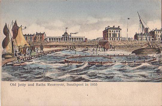
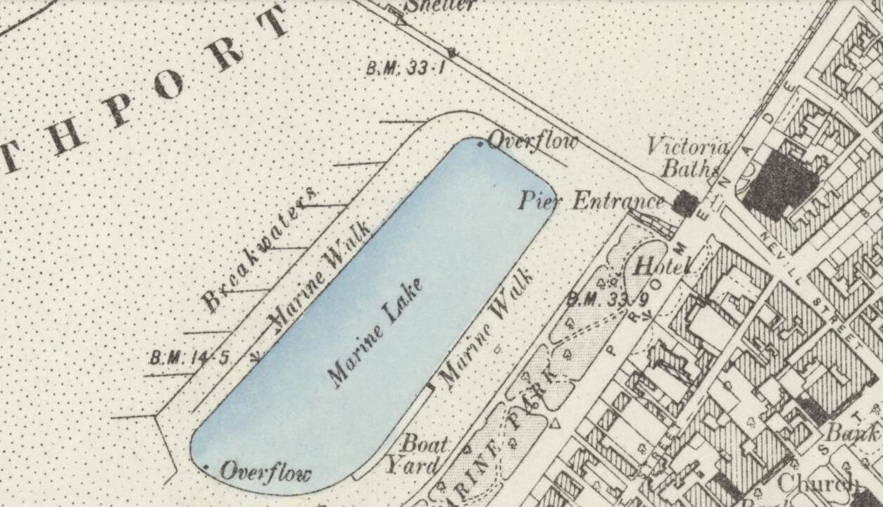
There is something immensely satisfying about seeing the three dimensional version after puzzling over the map. The rickety pier was soon replaced and the reservoir seems to have vanished by 1894 and the next map. The Victoria Bath perhaps used the Marine Lake that appears on the map just to the east of the impressive new pier (with tramline!).
Beach decided to write this post to ask readers to solve a mystery. But then he succeeded in solving it himself. He offers the findings here for future searchers on the Lancashire coast. Anything else on the Victoria Reservoir: drbeachcombing AT yahoo DOT com

