
Fantasy Britain by OS Maps September 9, 2015
Author: Beach Combing | in : Modern , trackback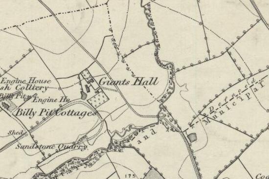
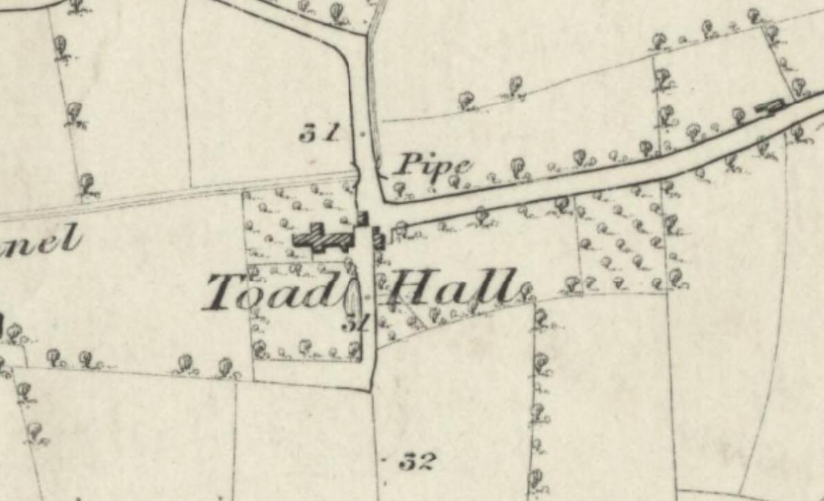
OK this is weird little game. Beach has spent many hours in the last two months looking at nineteenth-century OS maps, that is maps produced by the Ordnance Survey, the government body that is responsible for charting Britain, and back in the day, Ireland. The maps are beautiful, they lack the gaudy colours of today and there are no distracting contours. They have been sketched out expertly by capable draftsmen with good discipline. However, Britain being Britain these men were faced with many bizarre places and bizarre names all too often inhabited by prosaic folk who belied their landscape. Beach has gathered some of these together to create a kind of fantasy world made of fragments from real maps. Again, if you could go back to c. 1850 when most of these were inked down we would find unremarkable places. But as they remain on the map and our imagination can fill them they can become portals to a nineteenth-century England that never was. Giant’s Hall, for example, above, was presumably inhabited by one of the last of his race. Toad Hall, below, might be the original for Kenneth Grahame’s famous book and character.
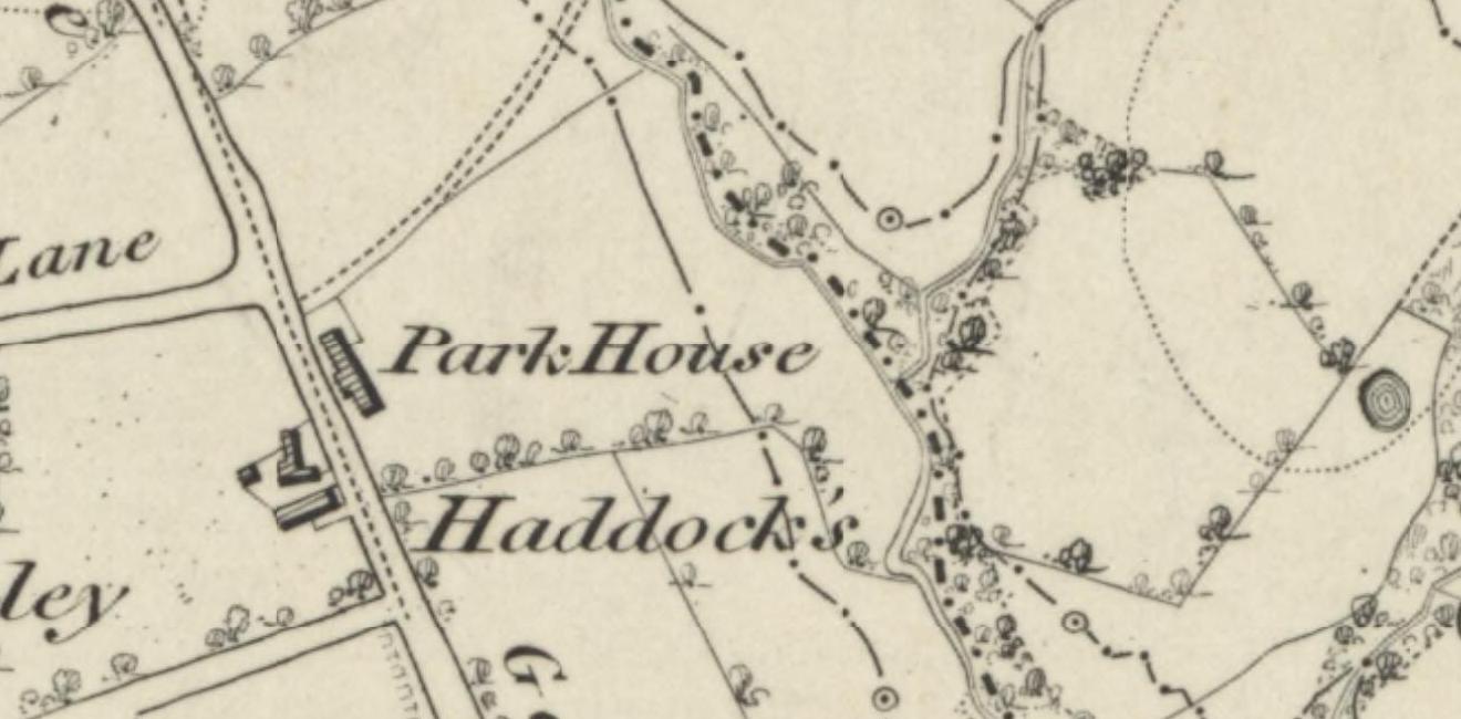
Thinking of fictional buildings could this be Marlinspike the home of Captain Haddock in the second half of the Tintin series? Sadly Park House, across the way, looks more like the original
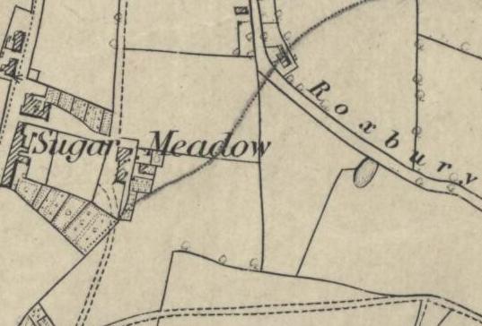
Beach thinks of Sugar Meadow as a steaming plantation of sugar cane just off the Pennines: God knows what nineteenth-century nastiness got it this name. A hang out for prostitutes? Treacle Row or Treacle Road was often used to refer to the poorest street in a town.
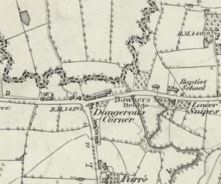
And here is a place you don’t want to go after dark
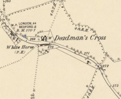
Here is the creepy Deadman’s Cross (note that all the screen captures above are from Lancashire, all the captures below are from Bedfordshire)
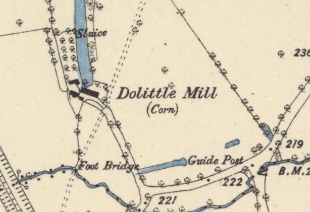
Beach’s personal favourite is Dolittle Mill where the locals slept through their shifts
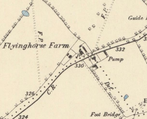
Or what about Pegasus, sorry Flyinghorse Farm?
Other entries from old maps for a Fantasy Britain or America: drbeachcombing AT yahoo DOT com
30 Sep 2015: Beach favourite (as a bit Tintin fan) was Julian’s contribution
There is a village near where I live called Tintinhull on the map, though the locals pronounce it Tin’n’ull, with a glottal stop in the middle such as people use when they don’t pronounce their Ts, and without the H. But I learned from the respectable source of the National Trust property in the village that the original Saxon name was Tyncknoll, which is pronounced almost exactly as the locals still say it, and which means the wooded hill by the water or lake. It is my suspicion that the current spelling is due to over-zealous Victorian surveyors trying to correct what they took to be lazy local pronunciation. That would be funny if true, though I might be wrong. I wonder if there are other examples.

